Property Record
3166 Thomas St, Memphis, TN 38127
NEARBY LISTINGS FOR SALE OR LEASE
-
-
View all Memphis listings for sale on LoopNet.com
Property Detail
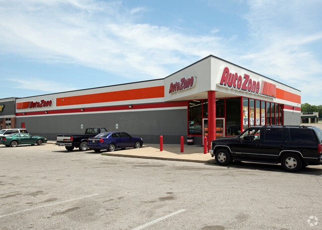
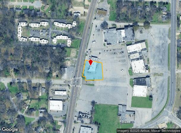
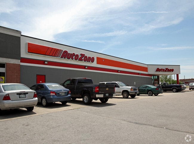
3166 Thomas St
Memphis, TN-MS-AR
Northgate Shopping Center C-P Phase 2
06-9032-0-0028
ES THOMAS SEE MAP GRID 91 L
Storebuilding
Shelby
X
Tennessee
05035C0375E
2
2024
0.91 AC
2025
North
009902
Memphis
7,360 SF
DEMOGRAPHICS near 3166 Thomas St
1 Mile
3 Mile
5 Mile
2024 Total Population
8,335
35,248
100,199
2029 Population
8,478
35,529
100,659
Pop Growth 2024-2029
+ 1.72%
+ 0.80%
+ 0.46%
Average Age
34
35
37
2024 Total Households
3,012
13,255
41,329
HH Growth 2024-2029
+ 1.66%
+ 0.66%
+ 0.36%
Median Household Inc
$29,290
$39,084
$39,478
Avg Household Size
2.70
2.60
2.30
2024 Avg HH Vehicles
1.00
2.00
1.00
Median Home Value
$62,054
$75,577
$99,301
Median Year Built
1963
1966
1965
Nearby Places
Map Layers
Map Styles
 Street
 Aerial
- Restaurants
- Banks
- Shops
- Fitness
- Groceries
PUBLIC TRANSPORTATION
COMMUTER RAIL
Central Station (Riverfront Loop - Memphis Area Transit Authority Trolley (MataTrolley))
DRIVE
WALK
Distance
Central Station (Riverfront Loop - Memphis Area Transit Authority Trolley (MataTrolley))
11 min
6.5 mi
AIRPORT
Memphis International
DRIVE
WALK
Distance
Memphis International
21 min
14.1 mi
Freight Ports
Port of Shreveport
DRIVE
WALK
Distance
Port of Shreveport
403 min
372.7 mi
Nearby Properties
Address
Land Use
TOTAL SIZE
Lot Size
Zoning
Address
Land Use
TOTAL SIZE
Lot Size
Zoning
81,088 SF
23.12 AC
RU-3
Address
Land Use
TOTAL SIZE
Lot Size
Zoning
1,913,224 SF
78.98 AC
IH
Address
Land Use
TOTAL SIZE
Lot Size
Zoning
2,912 SF
100 AC
CA
Address
Land Use
TOTAL SIZE
Lot Size
Zoning
111,016 SF
6.90 AC
CMU-1
Address
Land Use
TOTAL SIZE
Lot Size
Zoning
95,448 SF
8.04 AC
RU-3
Address
Land Use
TOTAL SIZE
Lot Size
Zoning
76,727 SF
13.03 AC
RU-3
Address
Land Use
TOTAL SIZE
Lot Size
Zoning
14,104 SF
3.95 AC
MDR
Address
Land Use
TOTAL SIZE
Lot Size
Zoning
92,798 SF
12.66 AC
RU-3
Address
Land Use
TOTAL SIZE
Lot Size
Zoning
76,727 SF
13.03 AC
RU-3
Address
Land Use
TOTAL SIZE
Lot Size
Zoning
82,859 SF
9.88 AC
MU
Address
Land Use
TOTAL SIZE
Lot Size
Zoning
56,620 SF
25.08 AC
R-6
Address
Land Use
TOTAL SIZE
Lot Size
Zoning
19,013 SF
3.51 AC
RU-3
Address
Land Use
TOTAL SIZE
Lot Size
Zoning
18,492 SF
8.35 AC
R-6
Address
Land Use
TOTAL SIZE
Lot Size
Zoning
53,176 SF
12.57 AC
RU-3
Address
Land Use
TOTAL SIZE
Lot Size
Zoning
47,756 SF
9.94 AC
RU-3
Address
Land Use
TOTAL SIZE
Lot Size
Zoning
35,890 SF
10.53 AC
RU-3
Address
Land Use
TOTAL SIZE
Lot Size
Zoning
10.26 AC
R-10
Address
Land Use
TOTAL SIZE
Lot Size
Zoning
39,628 SF
8.81 AC
RU-3
Address
Land Use
TOTAL SIZE
Lot Size
Zoning
48,194 SF
5.49 AC
R-6
Address
Land Use
TOTAL SIZE
Lot Size
Zoning
37,092 SF
4.30 AC
RU-3
Address
Land Use
TOTAL SIZE
Lot Size
Zoning
236,244 SF
11.24 AC
EMP
Address
Land Use
TOTAL SIZE
Lot Size
Zoning
62,008 SF
6.45 AC
RU-3
Address
Land Use
TOTAL SIZE
Lot Size
Zoning
30.25 AC
IH
Address
Land Use
TOTAL SIZE
Lot Size
Zoning
35,562 SF
1.45 AC
CMU-1
Address
Land Use
TOTAL SIZE
Lot Size
Zoning
56,185 SF
3.53 AC
CMU-3
Address
Land Use
TOTAL SIZE
Lot Size
Zoning
33,590 SF
10.46 AC
RU-3
Address
Land Use
TOTAL SIZE
Lot Size
Zoning
82,550 SF
7.84 AC
IH
Address
Land Use
TOTAL SIZE
Lot Size
Zoning
16,545 SF
3.25 AC
CMU-2
Address
Land Use
TOTAL SIZE
Lot Size
Zoning
213,547 SF
9.68 AC
IH
Address
Land Use
TOTAL SIZE
Lot Size
Zoning
449,255 SF
13.77 AC
IH
The World's #1 Commercial Real Estate Marketplace
Connect with us
© 2026 CoStar Group
The information above has been obtained from sources believed reliable. While we do not doubt its accuracy we have not verified it and make no guarantee, warranty or representation about it. It is your responsibility to independently confirm its accuracy and completeness. Any projections, opinions, assumptions, or estimates used are for example only and do not represent the current or future performance of the property. The value of this transaction to you depends on tax and other factors which should be evaluated by your tax, financial, and legal advisors. You and your advisors should conduct a careful, independent investigation of the property to determine to your satisfaction the suitability of the property for your needs.